


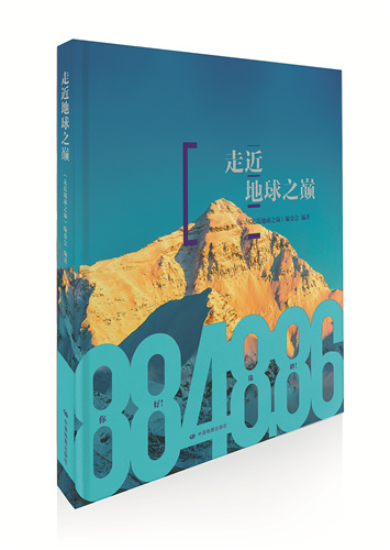
Scaling the height of success
Conquerors of Qomolangma attend launch of tome giving fascinating insight into the Himalayas, Yang Yang reports.


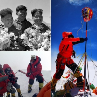
However, they needed time to install the devices to measure the elevation. It was the first time that the Beidou Navigation Satellite System and a Chinese gravity meter were used in the surveying and mapping of the peak.
For a while, Tselo even had to take off his gloves. Fortunately, they all made the descent safe and sound.
"It's a big honor for us because, even though we often climb mountains, it's not often we get to work on a scientific investigation," he says. "We encountered a lot of difficulties during the climb, but thinking about our predecessors in the 1960s, '70s and '80s, we were inspired by the spirit that helped them conquer the difficulties that, nowadays, we cannot imagine."
Besides the national mountaineering team, scientists also encountered a lot of difficulties during their work.
Wang Zhongyan, senior engineer with Institute of Tibetan Plateau Research, has been working at the institute's Qomolangma Atmospheric and Environmental Observation and Research Station on and off for the last 14 years. Most of the time, there are only two full-time staff members, one part-time worker, and dogs at the station.
He needed to climb the peak every year to set up their equipment at an altitude between 5,800 meters and 6,400 meters.
"Walking at such an altitude is like running a marathon in Beijing wearing five masks. Also, nobody can sleep well, although my fellow scientists say that I snored at night," he says with a grin.
Each survey and mapping of the elevation of Qomolangma displays the unremitting efforts of Chinese people to explore nature, and each improvement in the accuracy of the readings shows the advancement of China's surveying and mapping technology, writes Chen Junyong, academician at CAS, who took part in all the three attempts to survey and map the mountain, in the prescript of the book.
"We hope that the book will provide a window through which readers can learn about Qomolangma and the Qinghai-Tibet Plateau, be a link between science and society, and make a bigger contribution to protecting the third pole and the harmonious coexistence of people and nature," says Chen Ping, general manager of the book's publisher.